Soil Investigation and Oceanography Survey for Sand Deposits on Panjang Isand
Construction and engineering activities carried out in a coastal area in the form of coastal protection development (breakwater, jetty), reclamation, as well as mining of sea sand for landfill reclamation purposes will affect the stability (equilibrium) of the coastal morphology of the area and its surroundings. In connection with the extraction of sea sand, the reduction in dredging sand at the mining location will result in changes in bathymetry which results in changes in the hydro oceanographic pattern. Changes in hydro oceanographic patterns on a coast can result in excessive erosion in the area and its surroundings.
Categories
Related items
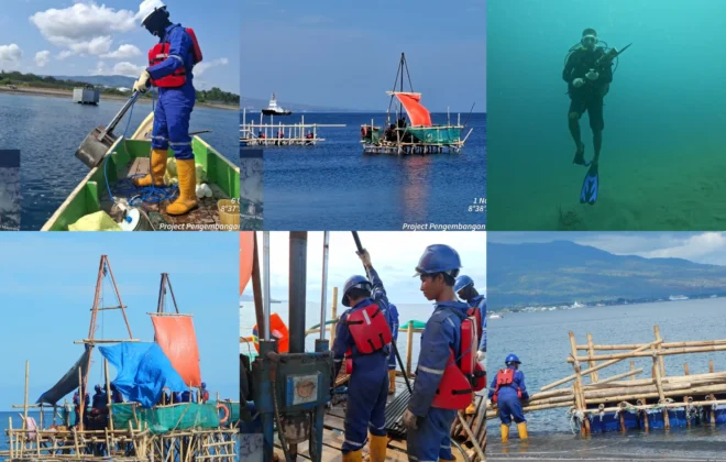
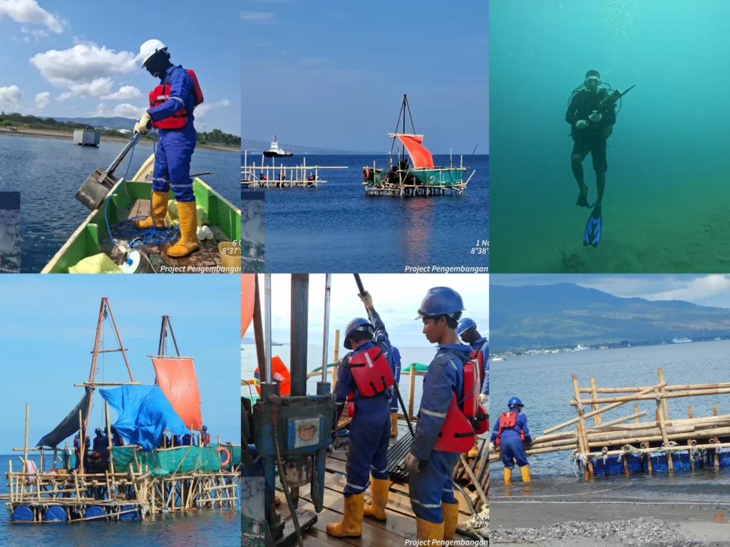
Onshore and Offshore Survey for the Fuel Oil Terminal Development Project in Maumere – East Nusa Tenggara
The survey project for Jetty Infrastructure – TBBM was entrusted to us by a Consortium…
Coastal Morphology Numeric Modeling in Boom Marina Area, Banyuwangi
Along with the development of tourism in Banyuwangi Regency, the economic aspect of Banyuwangi is…
Soil Investigation At Manyar, Gresik
Soil Investigation At Manyar, Gresik. Soil investigation work and soil testing laboratory work. Soil investigation…
Soil Investigation and Topography Survey Kijing Port, West Kalimantan
Soil Investigation and Topography Survey Kijing Port, West Kalimantan were entrusted to us by Apical…